Indiana: Republicans Run From Risk
Mapmakers avoided competitiveness, favored safer districts for all.
Topline Takeaways
Indiana’s new congressional map undergoes slight boundary changes but doesn’t produce any competitive districts.
The most consequential change to the map is in IN-5, the previously somewhat competitive district has shifted roughly 14 points toward Republicans, making the seat much safer for the party.
Who’s In Control?
Indiana’s redistricting process is completely controlled by the state legislature and requires gubernatorial approval before being adopted. Republicans are firmly in the drivers seat here as they hold a trifecta: majorities in both houses alongside a Republican governor.
New District Breakdown
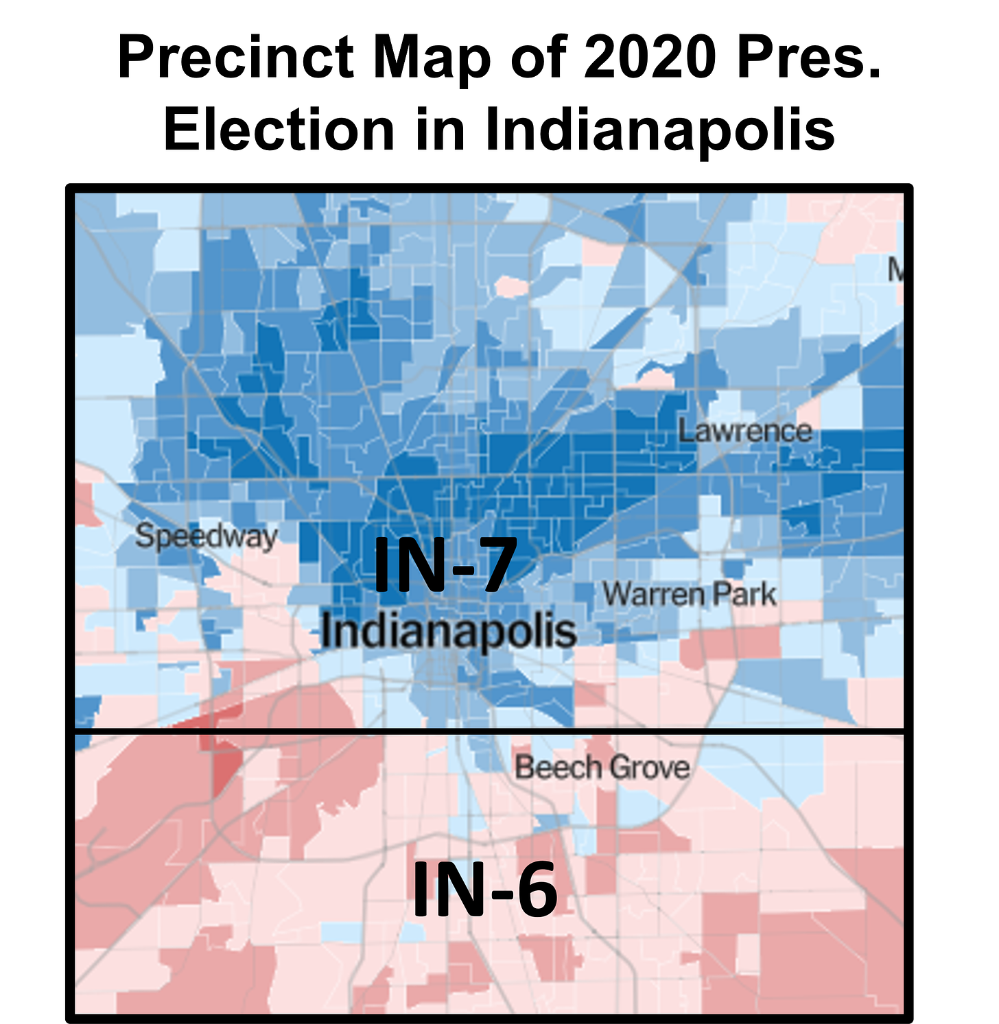
The map’s most consequential changes are in and around Marion county, home to Indianapolis. Marion county holds 903,000 residents, enough to force the county to be represented by two districts at minimum. The old map put the northern third of the county in IN-5 with the “lower” two-thirds of the county making up its own district designated IN-7. The old configuration put many of Indianapolis’s Democratic voters into IN-5. This coalition has been growing, making the state’s fifth district increasingly difficult for Republican candidates. So Republican mapmakers abandoned the goal of cracking this coalition across two districts and instead packed Dems into a deep-blue dot on the map. These changes swing IN-7 by 15 points toward Democrats, making the district one that would have given Biden a 43-point edge in the 2020 election.

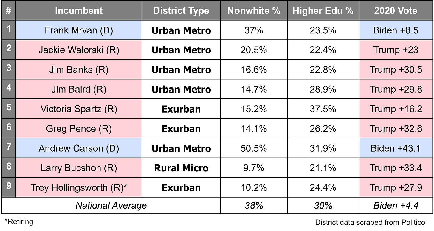
While the move creates an even safer Indianapolis seat for Democrats, the byproduct is two safer Republican districts in IN-5 and IN-6. Removing northern Indianapolis Democrats from IN-5 takes the district from a competitive 2-point lead for Republicans and transforms it into a safe seat favoring Republicans by nearly 16 points. Meanwhile, the new IN-6 still leans heavily toward Republicans. (Trump won the areas in the new district by over 30 points.)


